GeeksGoPeaks Svalbard Expedition 2025
What is Svalbard anyway ?
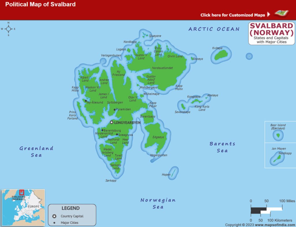 Svalbard is an archipelago off the north coast of Norway and is a very interesting place from many angles. It is the northernmost place you can easily get to – a regularly scheduled 3-hour flight from Oslo takes you to Longyearbyen, the capital of the Archipelago, and the largest settlement. At 78 degrees north, it is closer to the North Pole than Oslo.
Being so far north, it has a polar night of 84 days and a long period of midnight sun with sun setting for the first time around August 25th. There are less than 3000 permanent residents at Longyearbyen, by far the largest settlement on the island, and just 1200 beds to accommodate tourists.
Svalbard has a special status – governed by the Svalbard treaty, which gives it ownership to Norway but allows other countries to operate in it. It is not part of the Schengen zone, and you do not need a work permit to work or open a business there.
The Arctic wilderness is just steps away. It is raw, untouched wilderness with no trail, bridges, or well-prepared camp sites. There are a lot of remains from old mining towns and exploration expeditions. Due to arctic conditions, everything degrades very slowly, and you can glimpse into the past, frozen in time.
Polar bears are a real concern. You must carry a gun outside of the town borders. Restaurants here serve reindeer, minke whale, and even seal meat. Longyearbyen has some 40km of car roads, and most of long-distance travel is much easier with snowmobiles during winter, which is by far the most popular motorized transport in town.
 Most tourists coming to Svalbard choose to lodge in Longyearbyen, which has many very comfortable hotels with most of the modern amenities you would expect, and they do day hikes and boat rides from this base.
This was not enough for us; instead, we wanted to do a completely autonomous 4-day hike, staying in the wilderness in tents.
The initial plan was to take a boat and hike by some glacier, but it did not work out as someone made a mistake of offloading diesel in the local gasoline supply, making it useless, so the small gasoline-powered boats we planned to operate could not be used, so we ended up trekking from Longyearbyen. Initially, I was disappointed as I thought this would ruin the opportunity of being truly remote… but actually, I think this was a much better route than the one we had originally planned, as it allowed us to visit a number of ruins and Russian ghost towns, which is something I find very cool.
Here is how it went:
Day 0, Aug 6, 2025
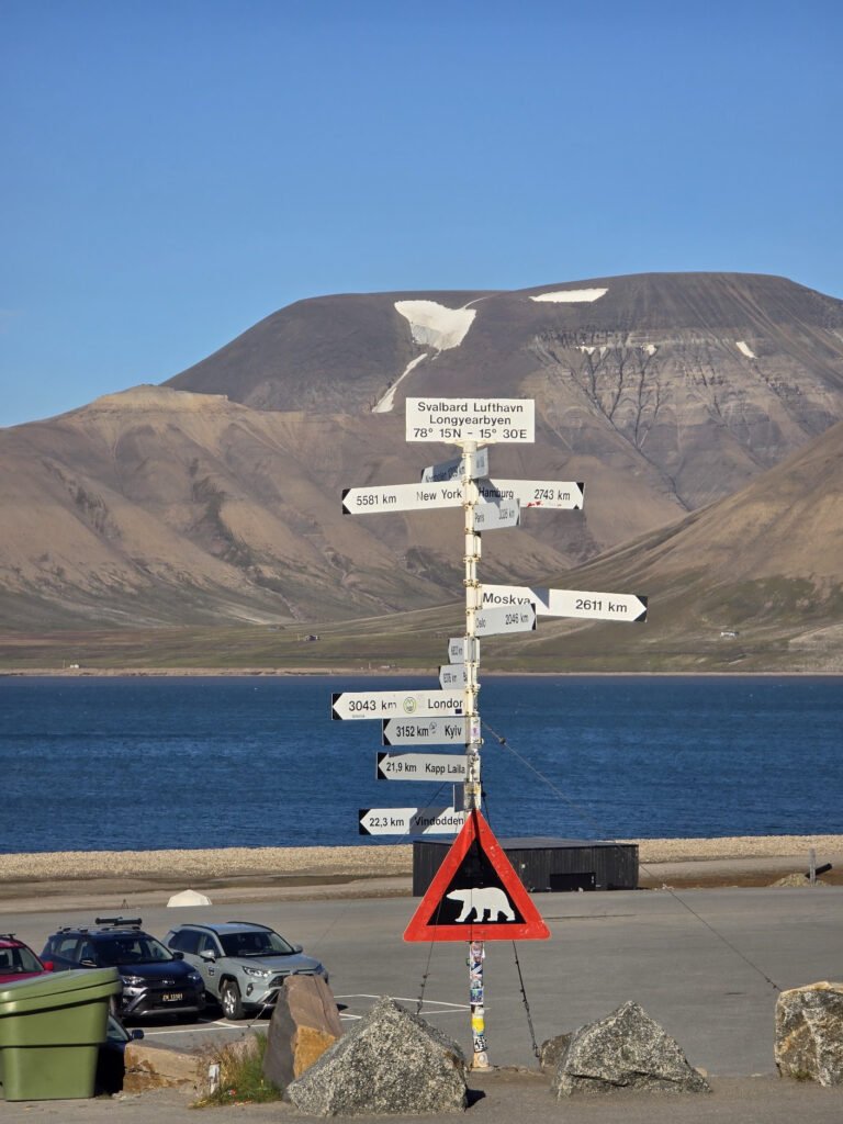
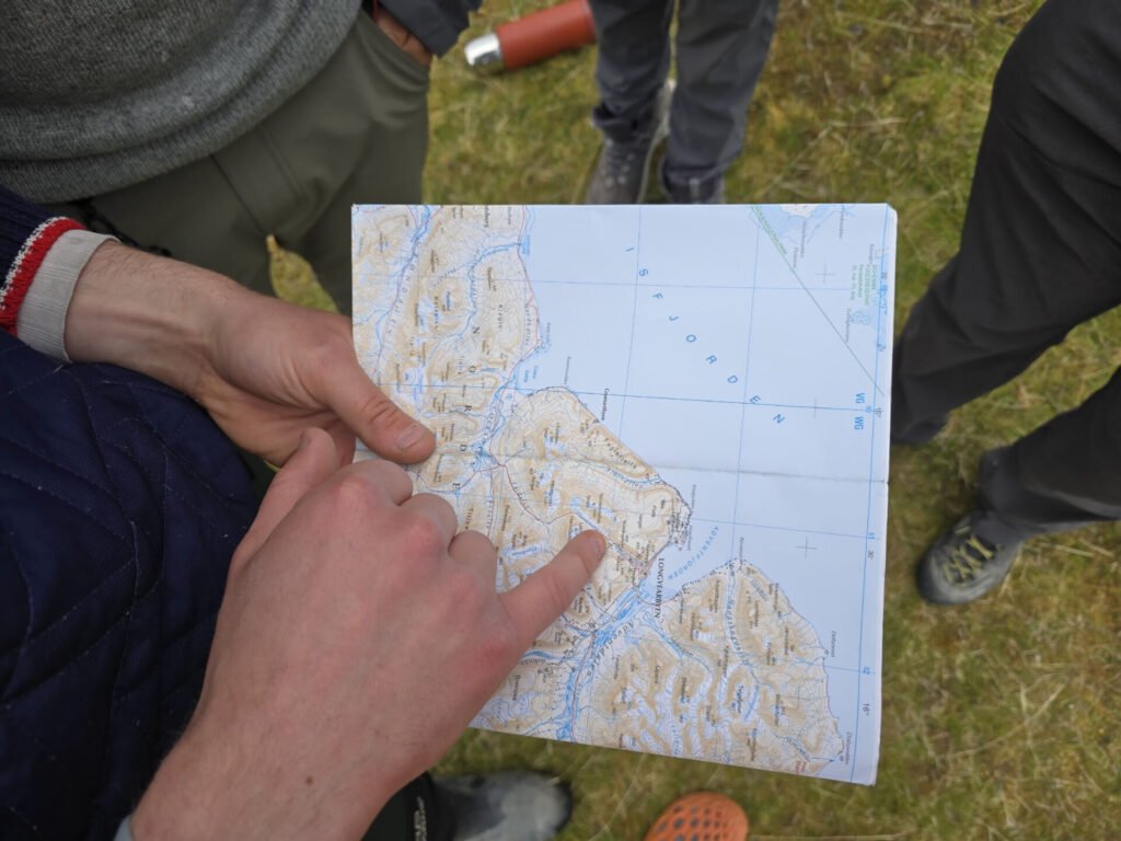
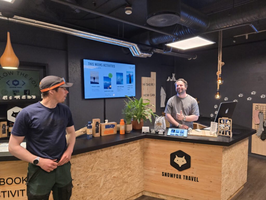
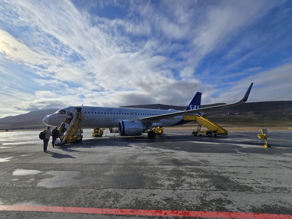
 We arrive from Oslo in the afternoon, a flight taking 3h or so. The airport is very small and efficient, and downtown is just a 10-minute ride away. We are met by our guide Erik and go to the office of our local partner – Snowfox Travel, to pick up additional equipment for our hike.
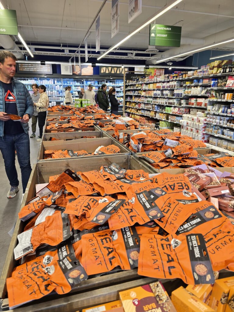
 We are getting freeze-dried instant foods for all our meals, which allows accommodation for vegan or gluten-free options, tea, hot chocolate, and a bunch of sweets for snacks. Selection is decent but not great, through the good news you can supplement it with whatever you like found in the large grocery store in town.
 Snowfox travel would also provide us with a Thermos, Nalgene bottle, poles, inflatable pads (some folks experienced leakage issues with those), -29C rated polyester filled sleeping bag, which was way too warm, large, and heavy for conditions (around +8C at night), and a sleeping bag liner.
I was glad I chose to bring my own much lighter and more packable sleeping bag and a proven sleeping pad.
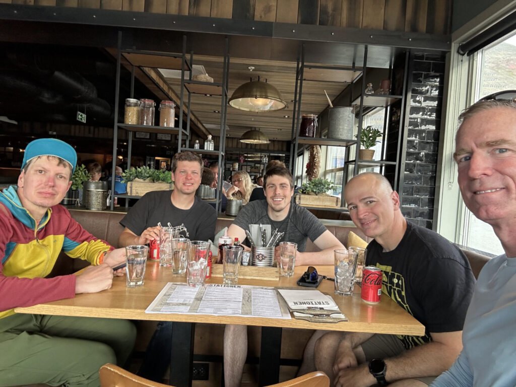
 After picking up our supplies, we check into the hotel, go to the local grocery store to pick up snacks, have a brief walk around the town, and go to the welcome dinner at the restaurant next door.
After dinner, we separate our “city stuff,” which we’re leaving in town, from the stuff we’re taking with us and get ready for the hike. The hotel told us we can’t really leave our bags with them for multiple days and instead had to leave our luggage with Snowfox Travel.
Our hotel (Svalbad Hotel), and it looks like many other hotels and museums have a no-shoes policy – you have to take off your shoes and leave them by the entrance… and you’re welcome to walk in your socks or borrow slippers.
Day 1, Aug 7, 2025
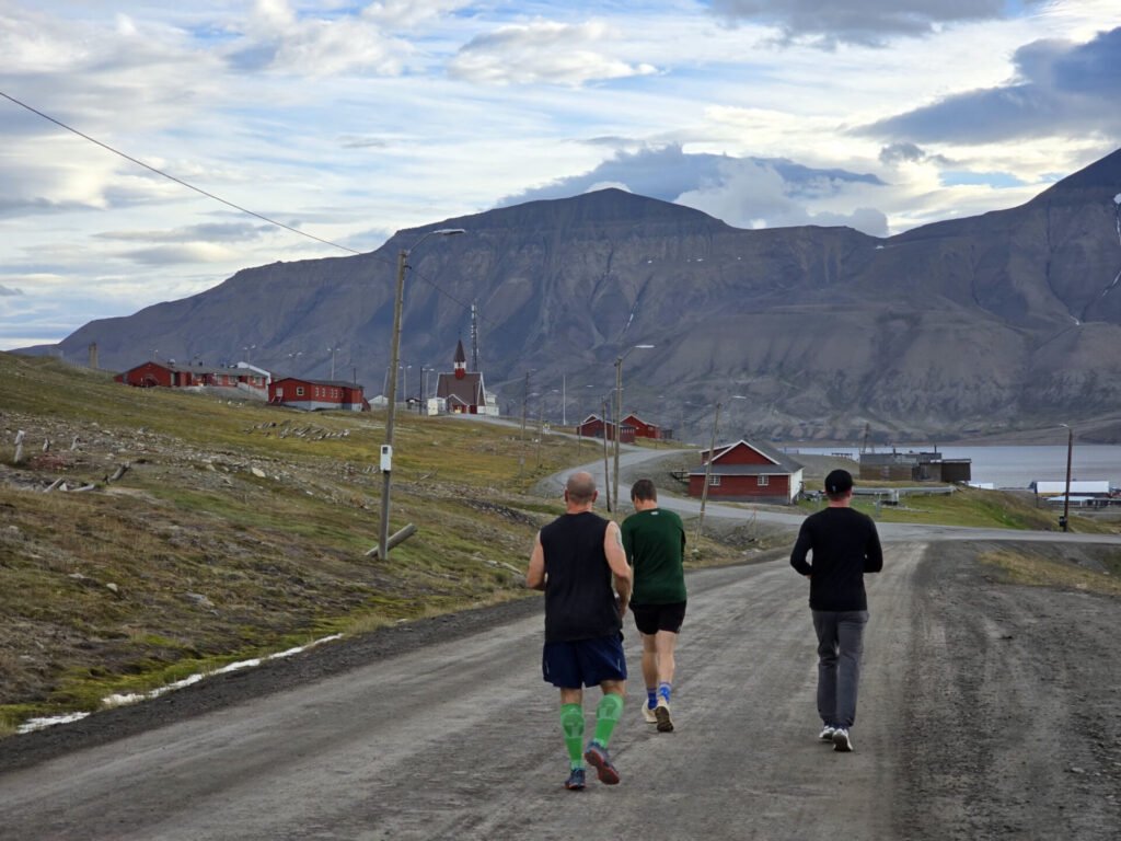 We met at 6:00 for a run. It was great that everyone in the group was a runner. Robbie found us a nice 5K trail taking us all through basically all the town. It is about 8C cloudy and windy, though we enjoy the run and it gives us a great feel for the city.
At 7:00, the buffet breakfast is served. It is surprisingly good for the remote location we are at. We also try to stuff up as this is our last “real food” for a while.
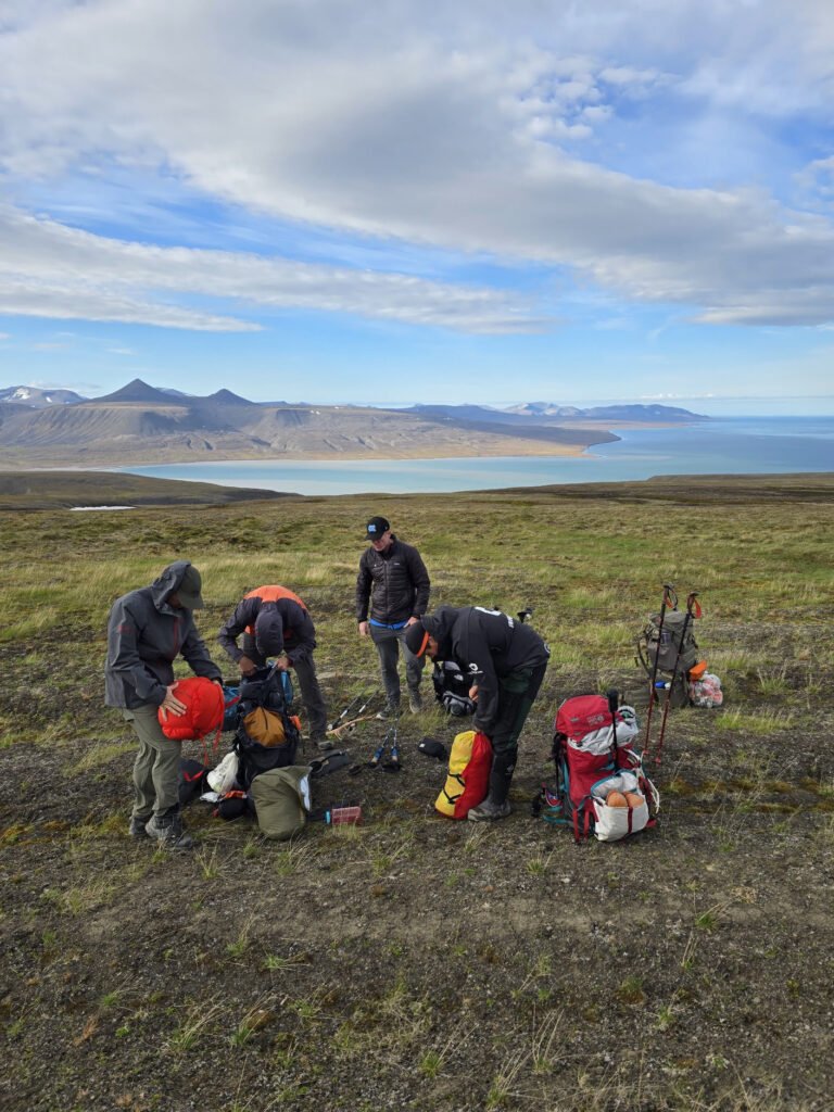
 We are picked up by Erik, drop off baggage, and drive about 10 minutes to the end of the road towards Longyearbyen Glacier. From here, we start our hike.
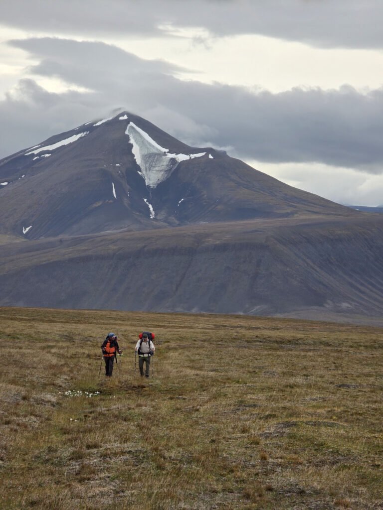
First 500 meters or so we go together by trail with a group which is doing a day hike to the local summit, but when we wander off trail and on moraine, and when open glacier.
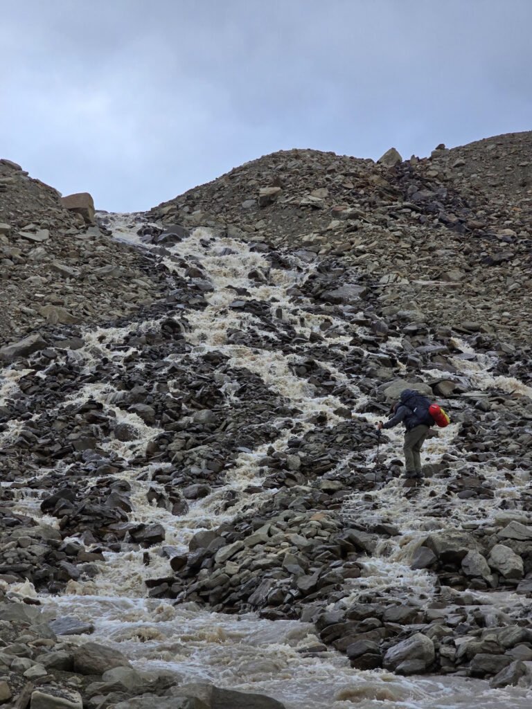
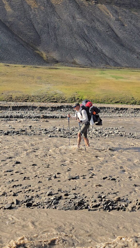
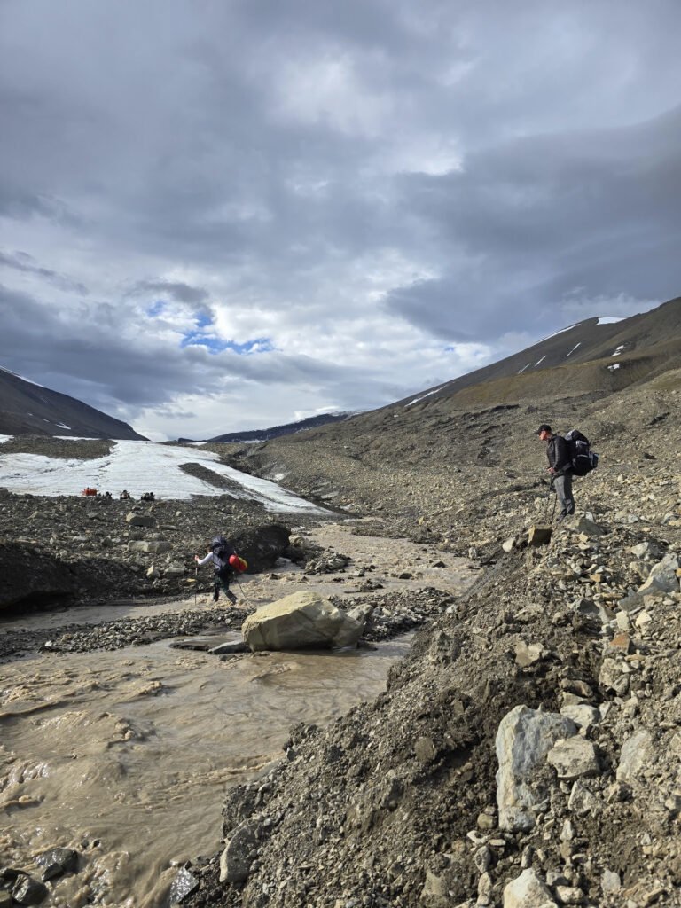 The first adventure that awaits us is a river crossing. It is not impassable, but on the high side for the season, as the weather was warm, so there is more glacier melt. It is good I have plastic shoes ala “Crocs” which we all can use for crossing. The water is ice cold, but feels good on your feet after walking. Alternatives to Crocs Crossing are either going in your boots and walking wet for the day, or going barefoot on sharp stones in a strong current, which is suboptimal.
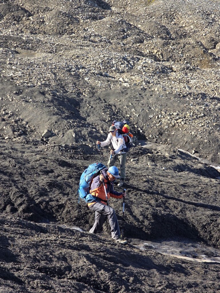
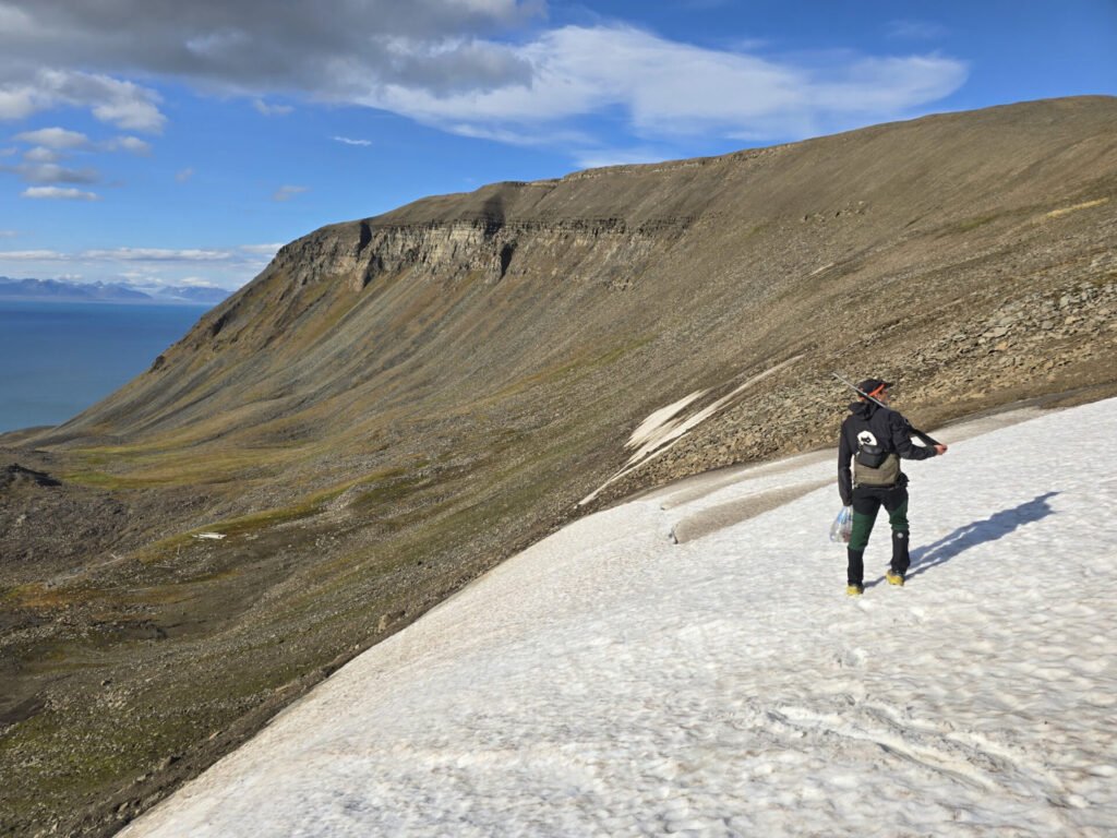
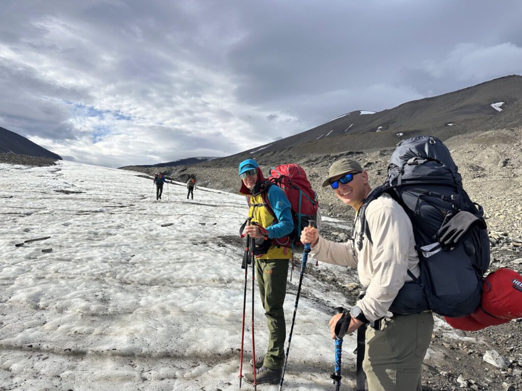 The glacier is wet and rather slippery. Erik told us to leave microspikes, as we surely will not need them. This created an additional fun challenge of training to walk on ice. Poles are helpful. It is also good that the glacier is not steep and does not have any significant cracks.
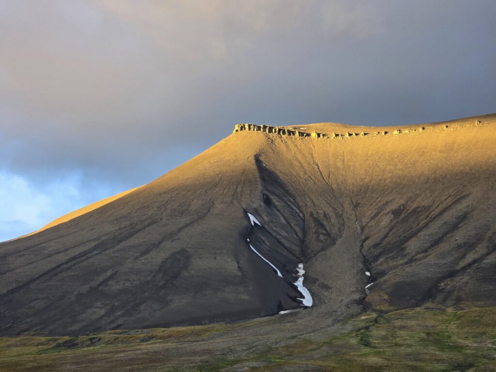
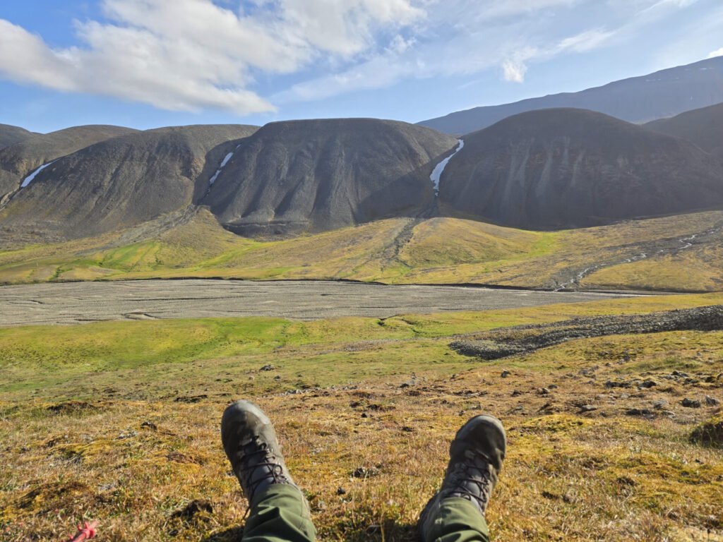
We get to the top of the glacier to the pass, which is just about 650m from sea level. Not surprisingly, this is the lowest altitude glacier we’ve seen.
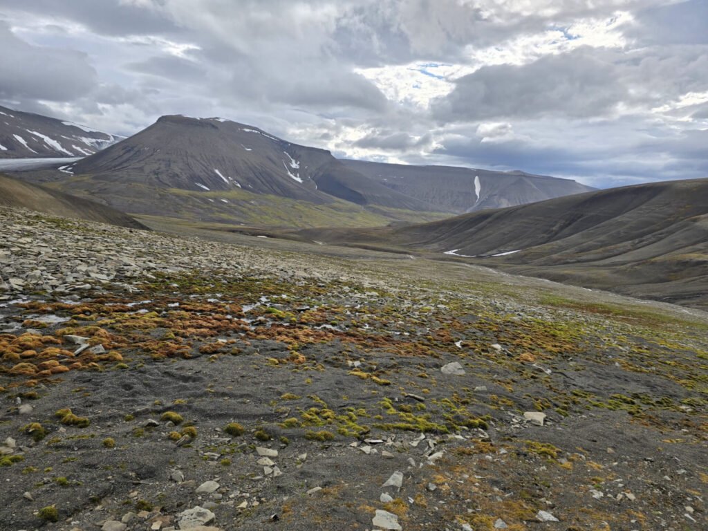
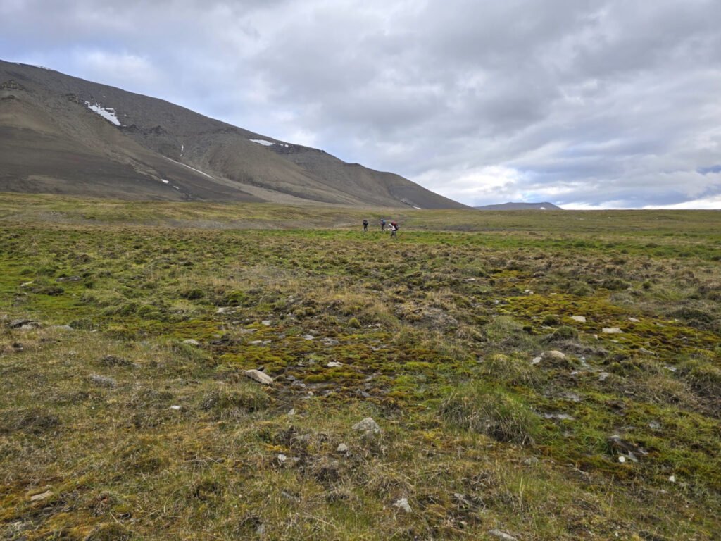
 We cross into the valley, which looks rather green below. There are no trees anywhere on the island, but there is a lot of moss and grass.
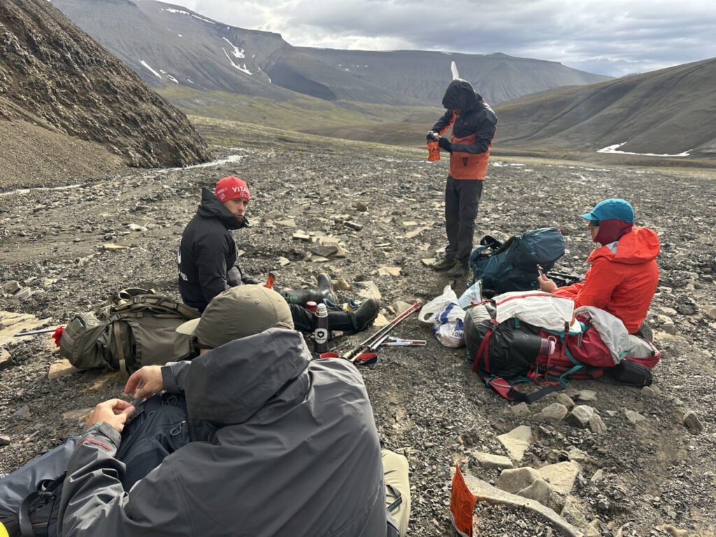
After a brief descent, we find a relatively wind-free spot and have our rehydrated lunch, then continue our descent to find a place to camp for the night.
 We had to cross one more significant river (which required shoe removal), which was quite fun and refreshing.
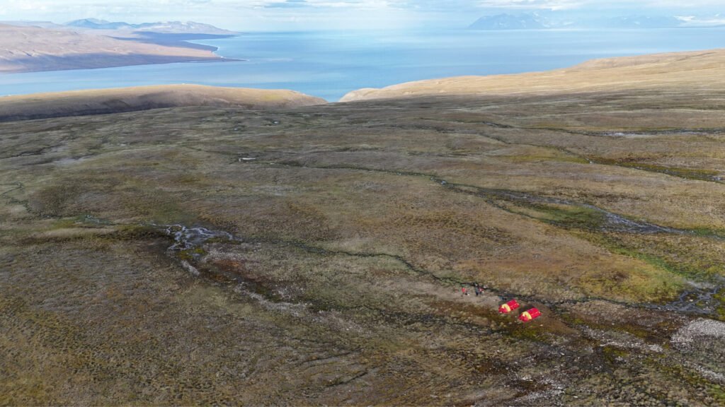
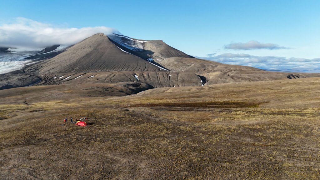
When you choose the camp here, you want it to be on the flat and reasonably dry and soft ground, close to the water, and have a good view of the surrounding terrain – you need to watch for Polar Bears, and you do not want to give them an option to sneak out on you.
 We found a good location near an old Russian drilling site which fit all of those requirements.
 The water situation is interesting – there are a lot of fast rivers in the area, yet they carry a lot of silt and are brown in color, and you do not want to drink that. What you’re looking for is running streams, but on the smaller side, which carry clean water. Because of the population of reindeer and the fact that it takes many years for excrement to decompose, you see it basically everywhere… including most probably your water source. Water is boiled but not additionally filtered before drinking, and you should believe it is enough. In our group, no one had any issues from consuming such water.
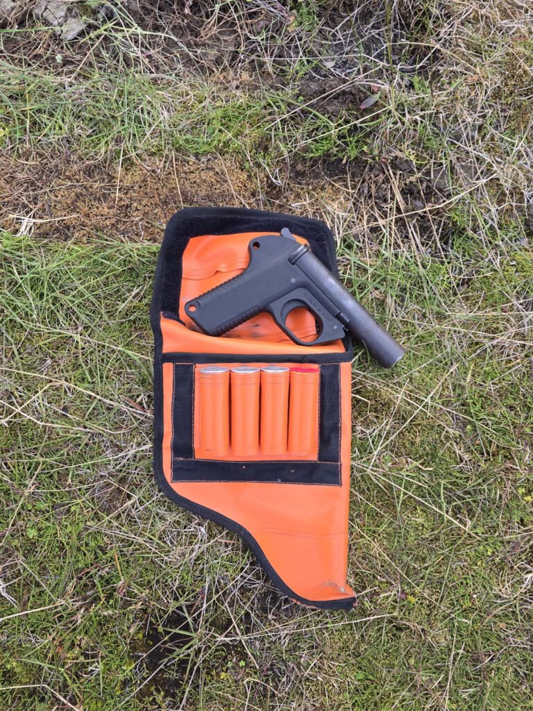 The most unusual thing about hiking in Svalbard is the Bear Watch. Local regulations and probably common sense require that there is a person awake on duty at any time to watch for Polar Bear. It is not super likely to see one as there are only an estimated 300 polar bears at Svalbard, which is more than 600.000 square kilometers, which makes it one bear per about 2000 square kilometers (though of course population is not evenly spread across all the land).
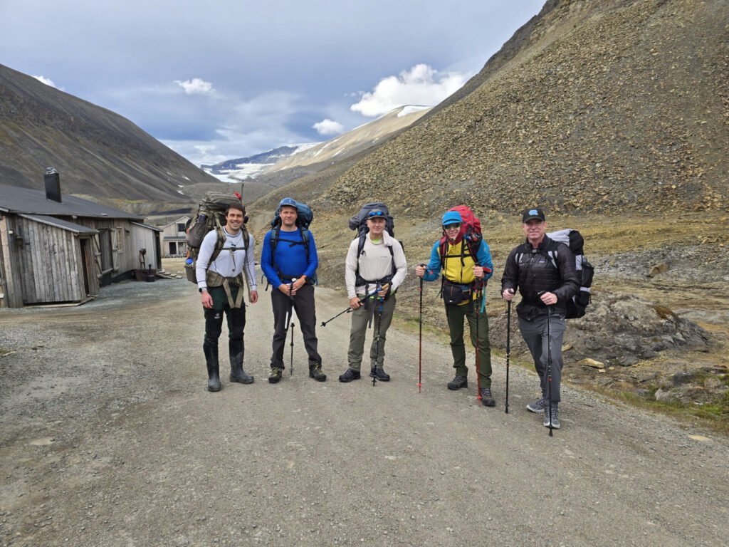
We have a group of 5 – 4 hikers and the guide, who does not technically have a dedicated duty but is on standby at all times with the rifle. We had split our shifts 10-12, 12-2, 2-4, 4-6, with the first and last shifts potentially being a little longer as people can go to sleep earlier or wake up later, but they also allow for uninterrupted sleep. First, we thought to rotate which shift you would have, but when we decided, it was most convenient to stick to the same schedule for all 3 nights.
During the Bear Watch shit you walk around the camp and watch out for Bears. You carry Flare, which you can use, and which can threaten the Bear and wake up the guide from the distance if needed, but the rifle stays with the guide for his exclusive use.
Another bear safety thing is to make sure you do not have food or food-smelling garbage in your tent with you; instead, it should be all placed in a separate pack – we used one of backpacks and placed it at least 200m away from the camp with hope that if a hungry bear there to come it would go for food, not for you.
If you wonder how you watch for polar bears during the night, I should remind you, during this season (we hiked Aug 7-10), the sun never sets, so it never gets dark.
Day 2, Aug 8, 2025
 I thought we would be up by 6, but with Bear Watch, we barely managed to get up at 7. After a quick rehydrated breakfast and coffee with cookies, we tear down our 2 tents and get going.
The weather is similar to the previous day, which is cloudy with rain sprinkles but no serious downpour or never-ending soaking drizzle, so getting wet from the top was not the problem.
 On the bottom, though, you often walk by the water-saturated moss, often sinking some 10-15cm into it. Good, really waterproof, not merely water-resistant shoes are a must.
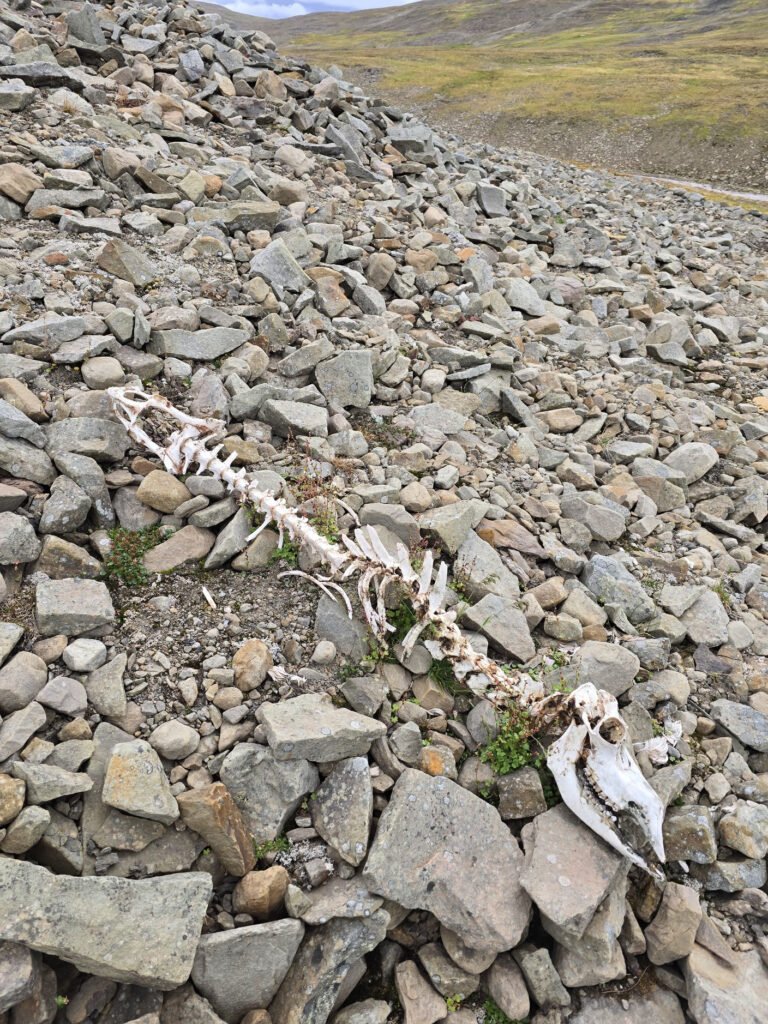
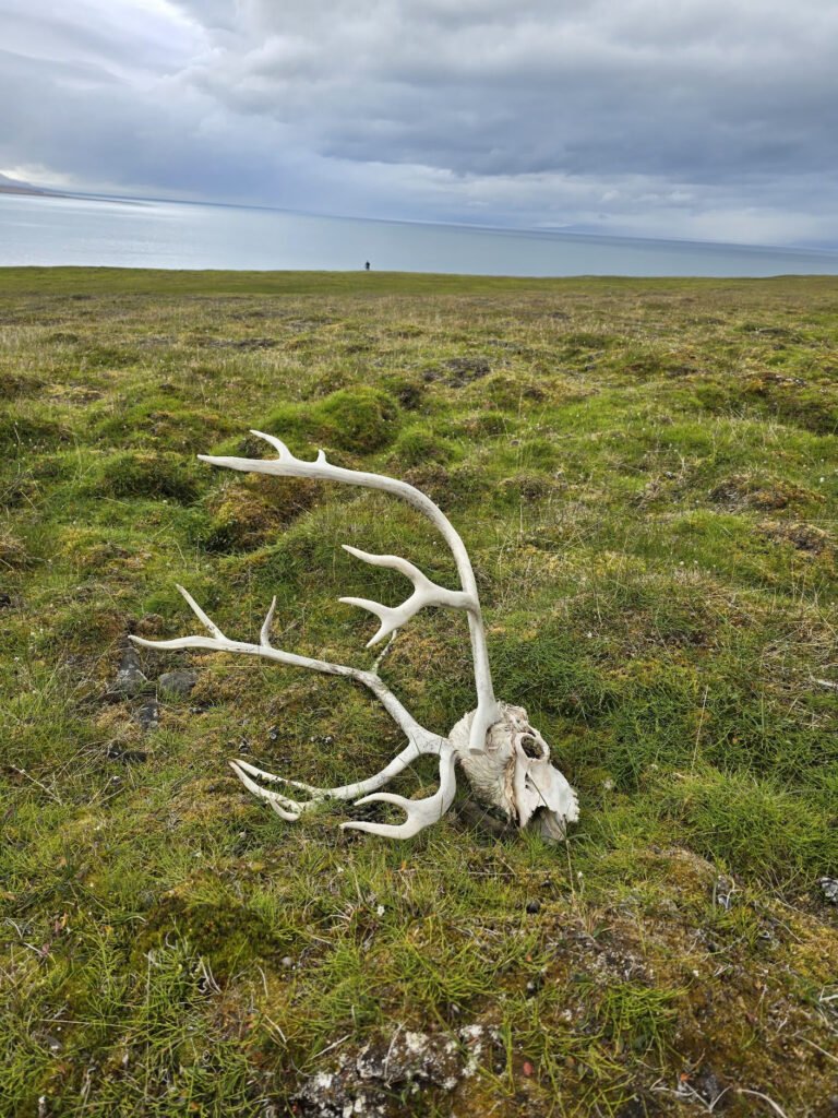
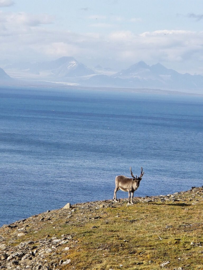
 Terrain generally goes up with some gulley crossings requiring us to go up and down. There are a lot of reindeer in this territory, and there are lots of antlers lying around waiting for you to pick them up as a souvenir if this is your thing.
 At some point, we reach something which resembles a long-abandoned road that Russian prospectors seem to have used to transfer supplies to numerous drilling sites we were passing.
This time we decided to only have a couple of snack breaks and have lunch when we reach the place for camp, which we do at about 14:00.
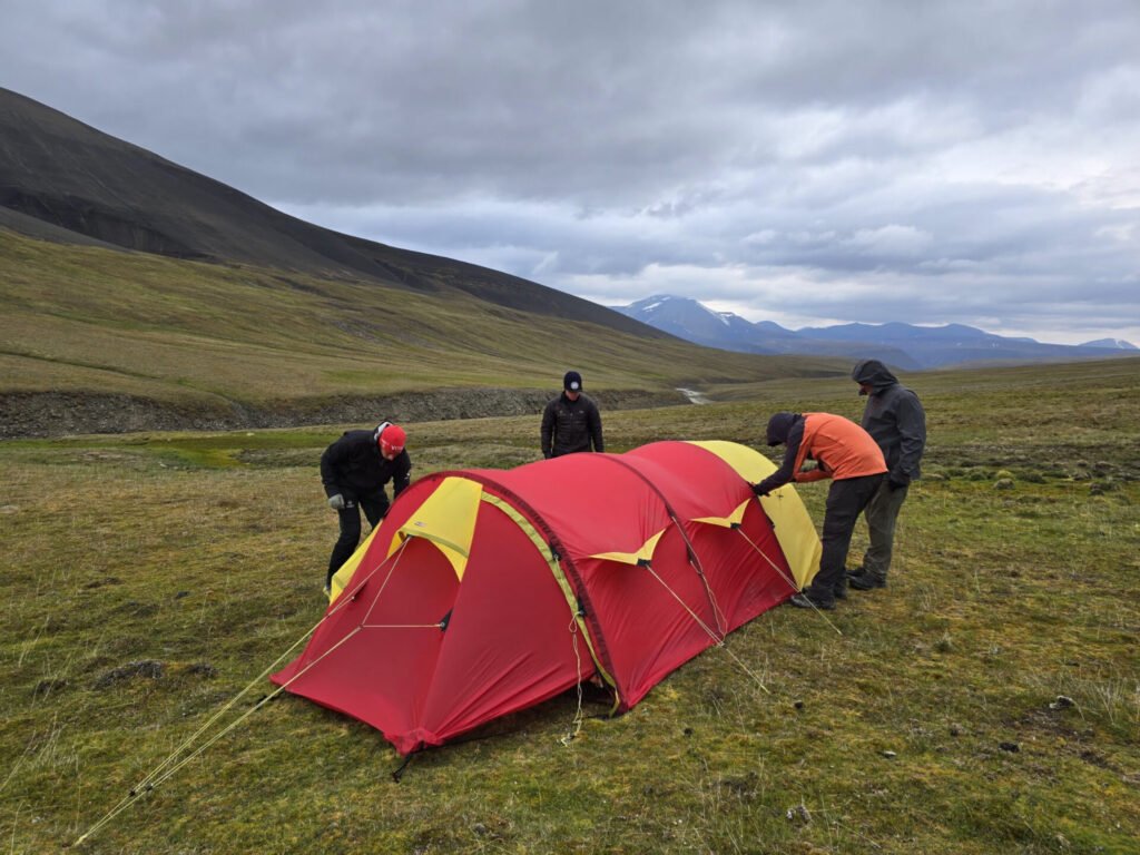
 This camp is set on the plateau with a good view of the surrounding area and water access, but it is more wet. Our tents are good quality, though, so no water seeps through from saturated ground.
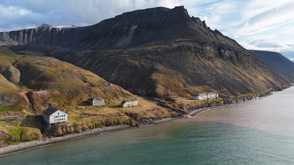
We set up the camp, have lunch, and in the afternoon we plan to leave our heavy backpacks behind and visit Coalsbuchta or Coless Bay – an abandoned Russian mining and port town. It is about 3km away from the camp, mostly going downhill.
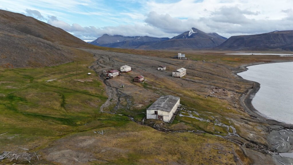
 Coles Bay is really cool – some buildings were moved and only stilts remain, some were clearly intentionally destroyed, and quite a few were still in quite decent condition, which was fun to explore.
As we were on the cliff overlooking the Coles Bay, we saw the boat leaving the town. Our guide Erik told us it looks like this is a boat attached to the research project with some scientists. By the time we descended, they were gone, so we could not learn what they were doing.
 I also use this opportunity to take some cool drone footage while some other members of our team do a “polar plunge,” going for a swim at a local beach.
I wish we had more time to explore this Ghosttown including buildings which are further out, but we needed to head back to the camp
Hike up was a bit longer as now we needed to ascend about 400m, but it was an easy terrain to follow
Day 3, Aug 9, 2025
 We pack up the camp and continue following this old track on the plateau, going slightly up for the first part of the day.
About half an hour into the hike, one of us discovers he is missing his phone; it is in airplane mode with disabled Bluetooth, so we can’t be sure if it is traveling with us or was left at the camp. Erik, with his experience, says it is not very likely for it to be left at the camp, as he checked it for garbage and forgotten items when we were leaving. An extensive backpack search takes place, and the phone is located deep in the sleeping bag. Crisis averted, and we can continue on our way.
 No rivers to cross, but there is a tiny glacier crossing. Eric is surprised how much things have changed compared to the last time he was at this spot about a year ago – glacier crossing became more dangerous and complicated as there is a meltwater running under the ice, and it is hard to know how stable the ice is
In the end, Eric finds the ice bridge he is reasonably satisfied with, and we have crossed the glacier rather uneventfully.
 From here, we go up to a rather dry hill by the shore. No snow remains on him, and so water sources are extremely limited. After failing to find any decently running creeks, Erik decides we camp in the nice, dry, and flat spot, but bring water with us when we do our afternoon local hike
You can see some abandoned buildings and a drilling platform from the camp – remnants of a Russian drilling expedition of the 1980s, which Erik says we will explore tomorrow.
After a quick lunch and setting up our camp, we went for the local hike to visit Grumant – the old Russian mining town abandoned in the 60s. It is a pretty long way down.
The descent takes us through some of the remaining snow, which guides suggest we can slide on. After a couple of people have a faster-than-intended exit on the rocks below that snow the rest of the group decide it is not such a great idea and go around.
 Descent continues off the beaten path, and we go over a series of very loose, unstable rock piles, which are fun for some but less so for others. About halfway, we get to what seems to be the remains of the old path, which workers probably used to take up the hill when the town was functional, which made descent easier.
To my surprise, Grumant is smaller and less preserved than Coles Bay – there are just a few buildings standing and a bit of abandoned equipment. Some of us went down to explore the buildings while others just enjoyed the view of the abandoned town, the bay, and the snowy mountains across it. The sun finally came out, and the view was gorgeous.
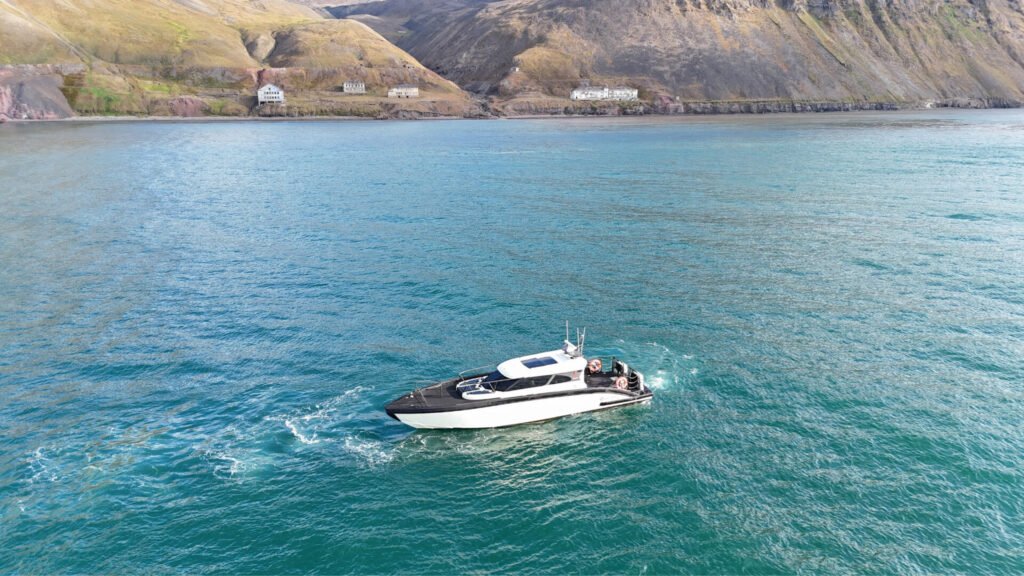
 We also saw the boat here, which Erik said is a tourist boat doing a tour here, probably after exploring the big glaciers across the bay. They spent a few minutes looking at the city and headed back to Longyearbyen. I used this opportunity to fly my drone and take some cool shots with a boat and an abandoned town in the background.
If I choose one, I would go to Coalsbuchta rather than Grumant, though it was fun to explore both.
With some 500m ascent ahead of us, we wanted to leave no later than 18:00, so exploration time was limited. Perhaps looking forward to dinner, we moved quickly and got back to the camp in about 1h 30 minutes, which includes stopping to fill water for our dinner and breakfast the next day, as well as climbing back over pretty steep inclines.
Day 4, Aug 10, 2025
Night was as uneventful as ones before – no Polar Bears were spotted by any of the sentries. The morning met us with gorgeous sunny weather, so we were looking at our best weather day yet.
We have our, by now, “standard” re-hydrated breakfast and coffee with cookies and tear down the camp quickly.
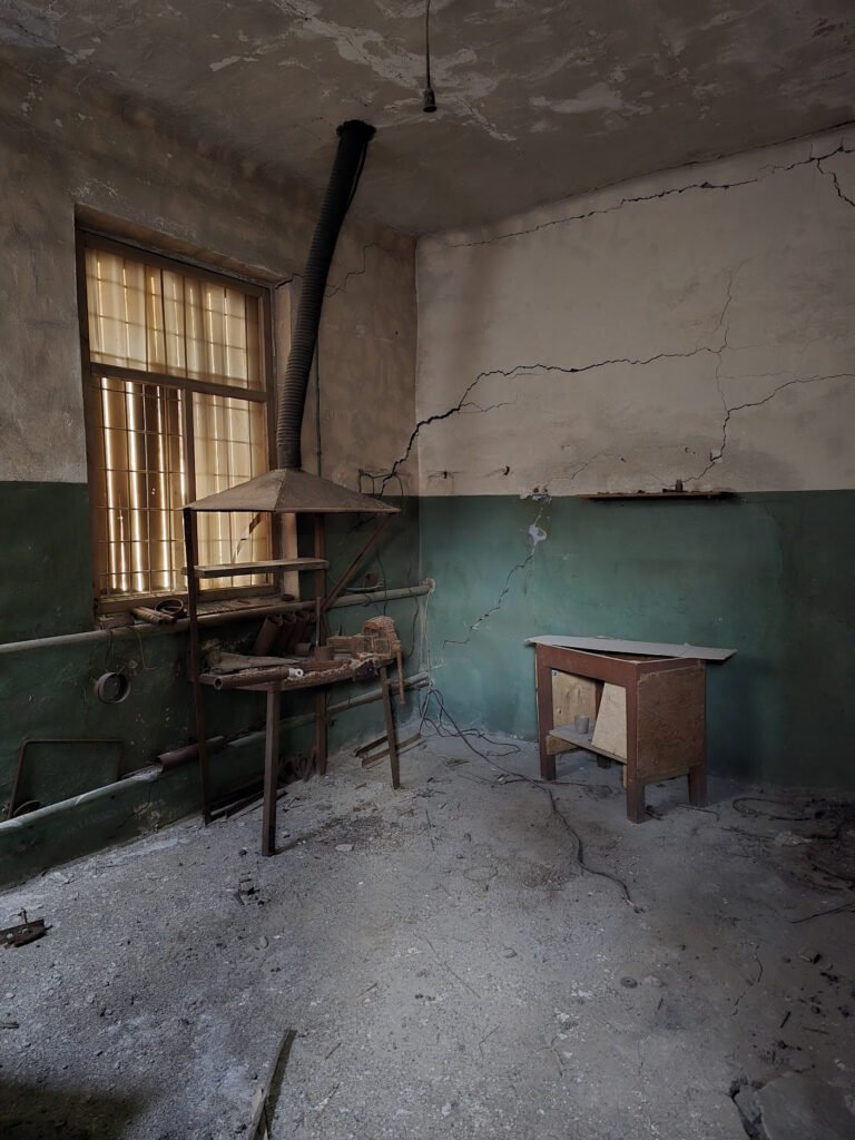
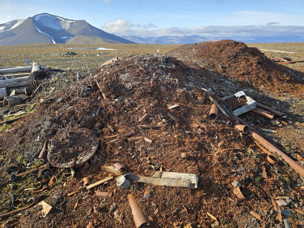
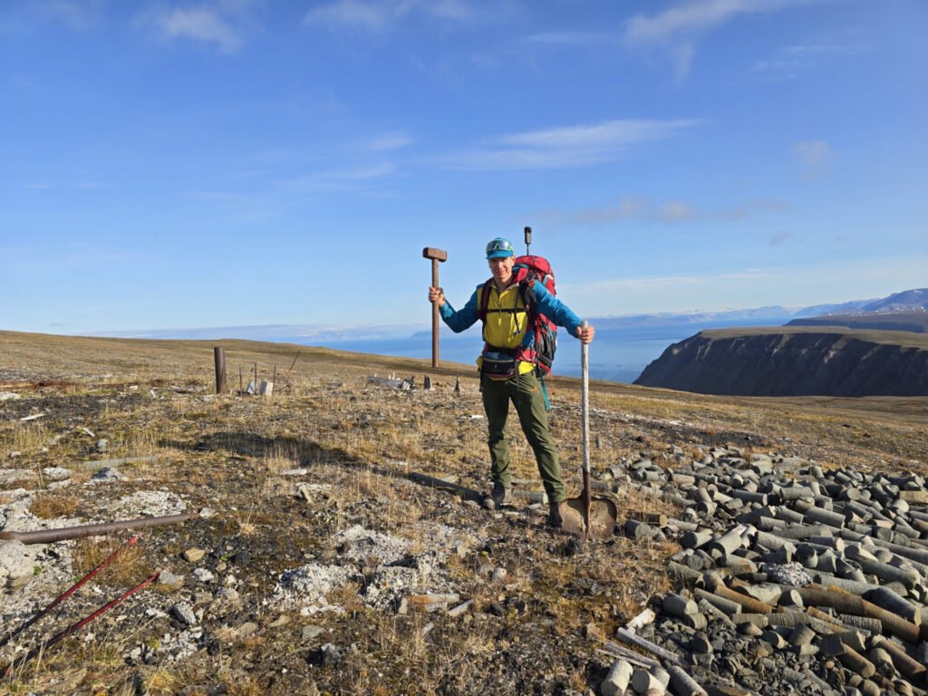
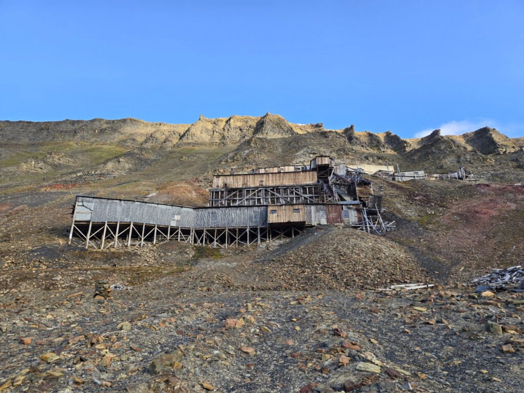
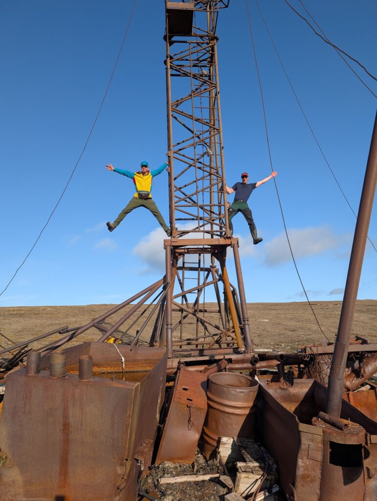 We go to explore an abandoned drilling platform. It looks like it is from the 1980s, based on date marks on some equipment, and also stable enough to climb, which we surely do.
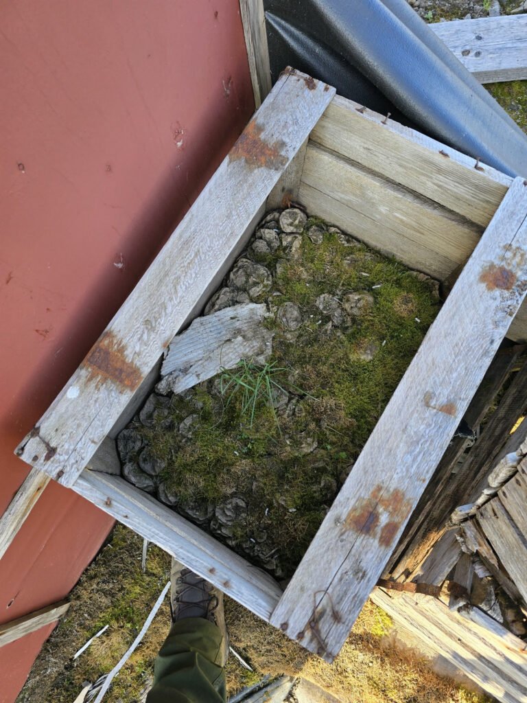
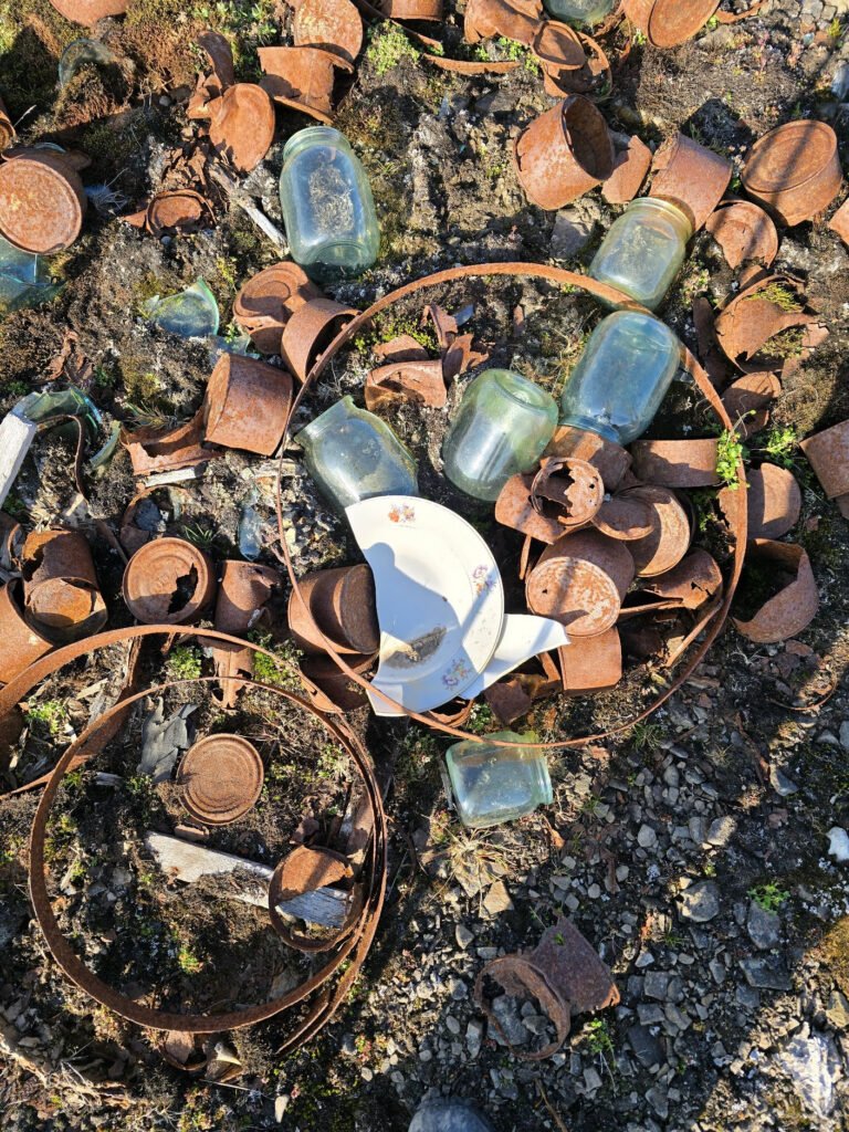 There is also a massive garbage field by the platform. Lots of cans and glass jars, and bottles, some still completely intact, yet virtually no plastic, reminding us how much garbage content has changed over the last 50 years or so.
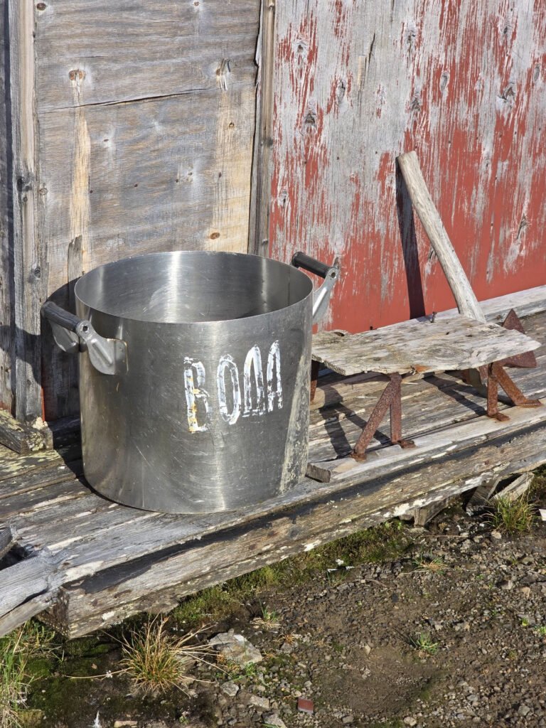 When we explore the cabins a couple of hundreds of meters away, where it looks like workers are lodged, we see soviet pots and pans and other soviet equipment from the 1980s, which very much reminds me of what was in use when I was at Kindergarten and during my early school years.
 We see several boxes of potatoes, which look like they were abandoned on the last departure. The soft potato inside has rotten away, but dried potato peels still remain, showing how slowly things degrade here. The fact that there are not many visitors, and the type of people who come to visit, also explains why it was not all picked as souvenirs or vandalized, as happens in many easily accessible places
 We continue towards Longyearbyen, and there are a few more abandoned drilling sites and some buildings to explore. It is fun to guess what it could be – for example, one of the ruins could be guessed to be a metal workshop in its glory days due to a huge pile of metal sawdust close to it.
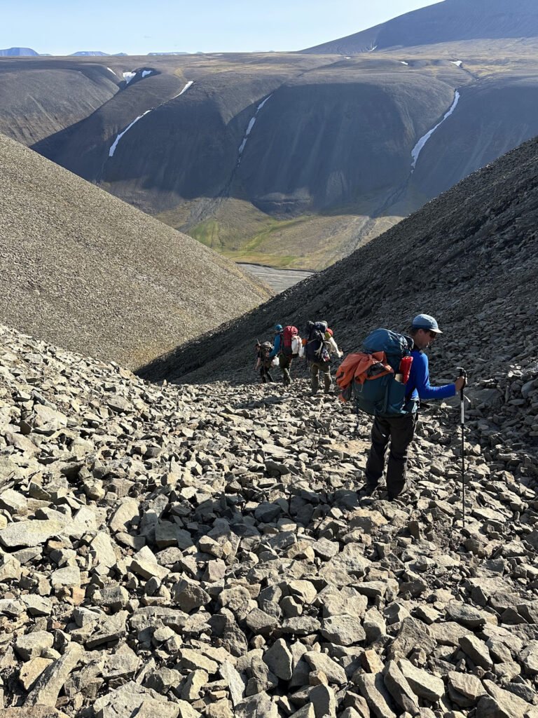
 As we continue on our way, we have to take a steep descent into the gulley through the loose rock. Which is not fun with heavy backpacks behind the back. Some of the members called this the hardest or most uncomfortable part of the trip.
 In the end, though we’re rewarded with a proper trail – first one we see in 3 days – it is used by day hikers from Longyearbyen. Quick hike by this trail and we’re down in the valley, probably the most beautiful and green we’ve seen since our start.
 Another half an hour hike down the valley, and we need to cross the river to get back. It is pretty wide and fast, so it takes some time for Erik to pick a time for us to cross. My “Crocs” get good use by everyone in the team again.
 Finally, we’re back into civilization – we get to the old mine and meet the first people since leaving Longyearbyen 3 days ago. Day hikers look at us, carrying big backpacks with a lot of interest.
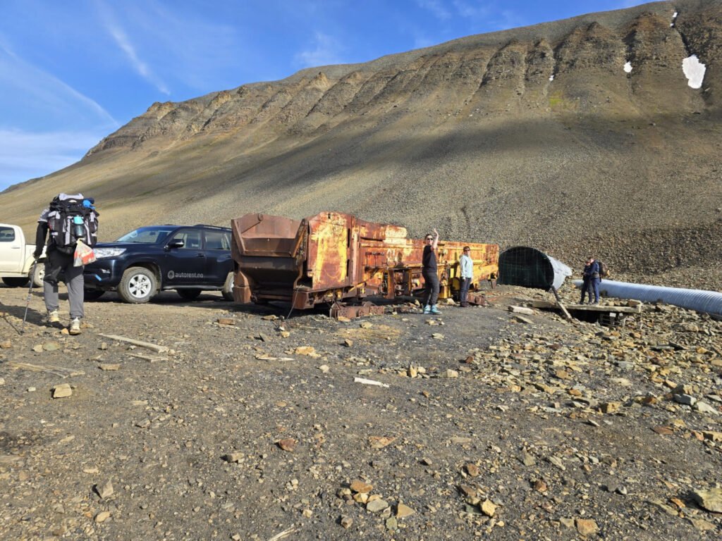 15 minutes more and we got to the car, which was left here for us by Snowfox Travel staff. Erik says they usually do not lock cars and leave keys inside, as no one steals cars in such a small community.
It is about lunch time and we’re all very committed to avoiding yet another rehydrated lunch, so we all go to a Thai restaurant, which as many things in Svalbard, carries “the most northern” destination. After living for several days on dried food and snacks, it feels really good.
 Snowfox travel folks tell us there is something they want to offer us – as they could not take us anywhere by boat, we can change the BBQ planned for tomorrow morning and go on the Bay Cruise on a catamaran instead. After a quick discussion, we agreed to this change.
After lunch, we have a bit of time for rest and/or shopping, though it is Sunday, so most stores (except the grocery store) close at 16:00.
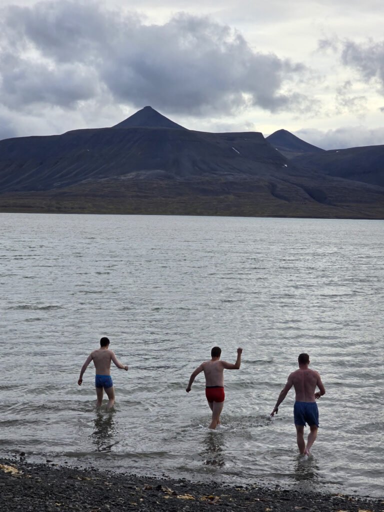
 Next in plans is a Sauna with the opportunity of a polar plunge. We enjoy it a lot – after multiple days of hard work, it feels good on the muscles. Everyone uses the opportunity to take a dip in Arctic waters this time around!
After Sauna, we have dinner and head off to sleep as there is another day of adventures ahead.
Day 5, August 11, 2025
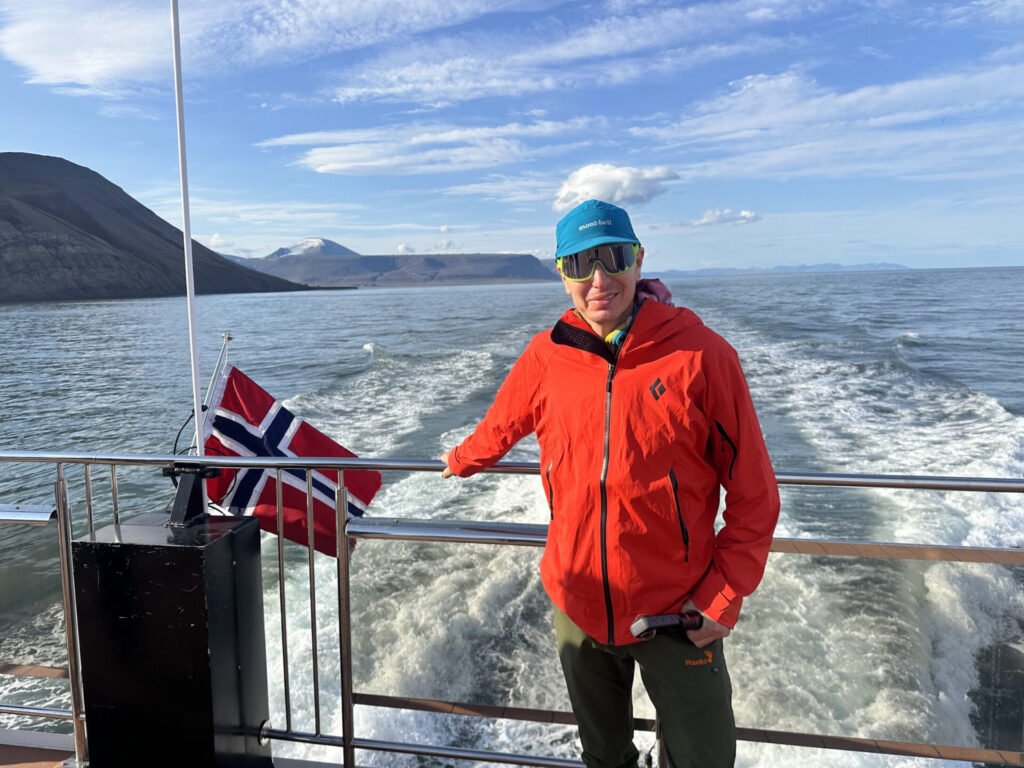 This is our “City Day”, though it is also now full of activities. We’re being picked up at 8:15 to go on the Cruise. With some miscommunication, we waited for Snowfox Travel guys to pick us up, where it was rather a bus, parking behind the hotel to pick people up for this activity. It was not super smooth, but in the end, we got on our cruise on time.
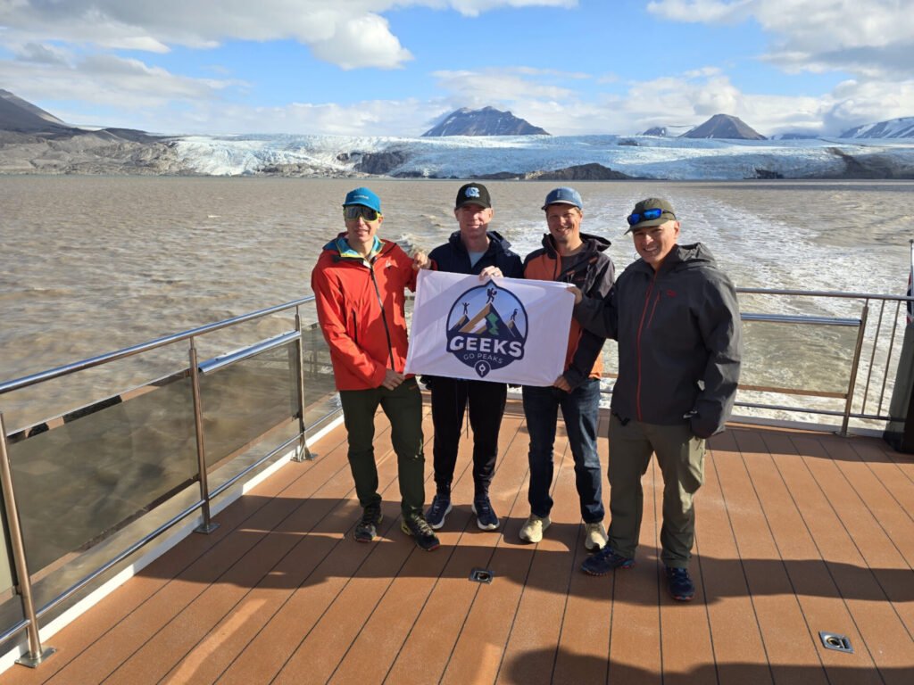
 The Catamaran was quite nice with 3 decks accessible to guests, and there were fewer than half of the maximum people on board. The day was also gorgeous with mostly sunny skies and almost no waves.
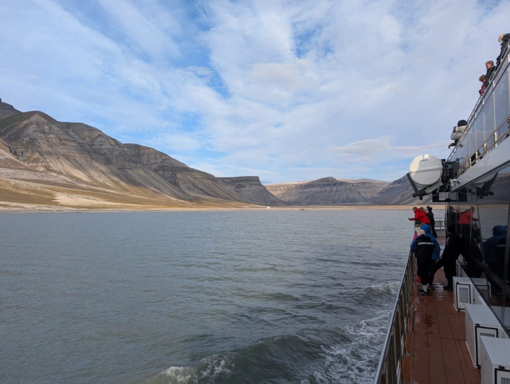
As they sailed through the bay, the crew did a presentation about Svalbard’s history as well as marine life and wildlife.
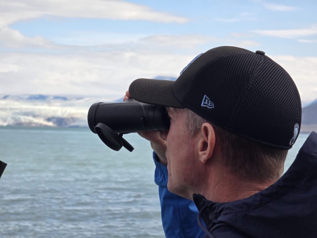 We saw Walrus, Puffins, Beluga, and Minke Whales while underway, but not particularly close.
There were some human-made attractions too – cabins, broken down ships, and abandoned mines, but the biggest and most interesting was the semi-abandoned Soviet town of Pyramiden, once one of the two major Soviet mining towns on Svalbard (the other being Barentsburg, which is still active). It was a popular place to visit before the Russia-Ukrainian war broke out. Now, most Western companies do not do commercial tours there, but some people still go there, and from what we heard, there is a hotel/bar that still functions.
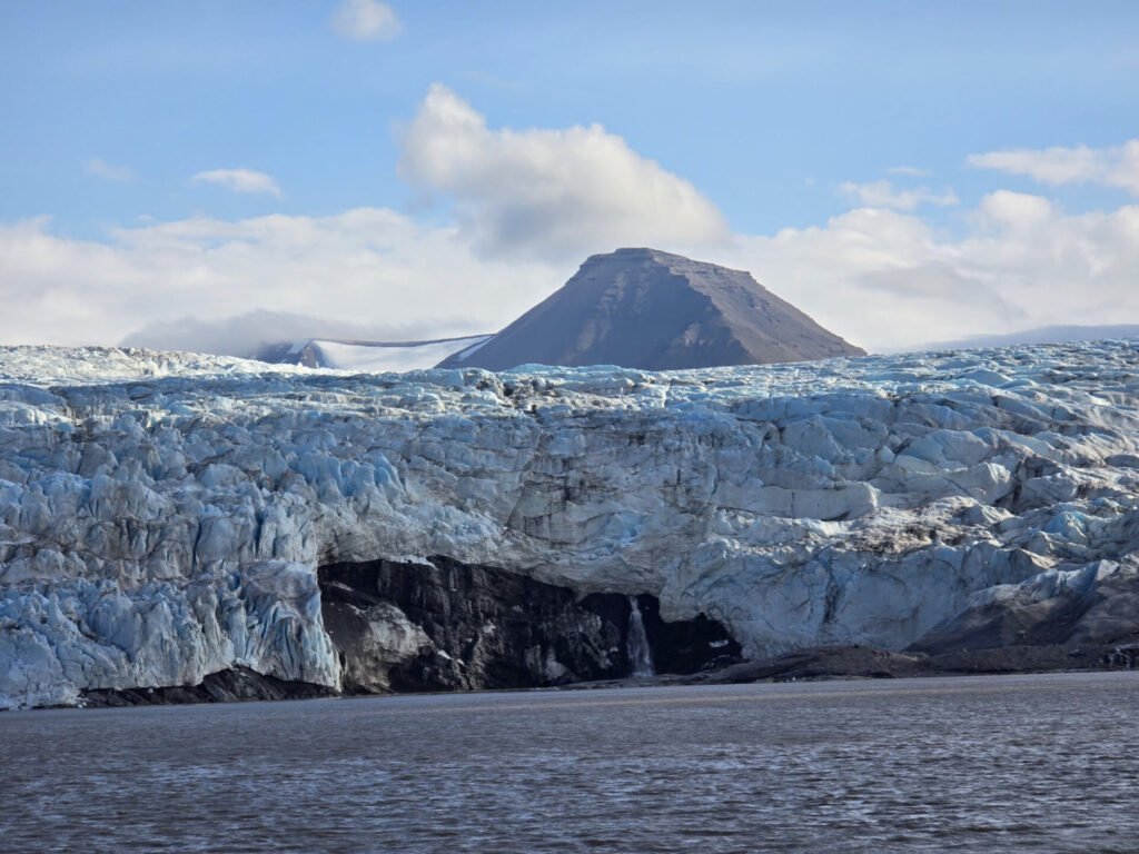
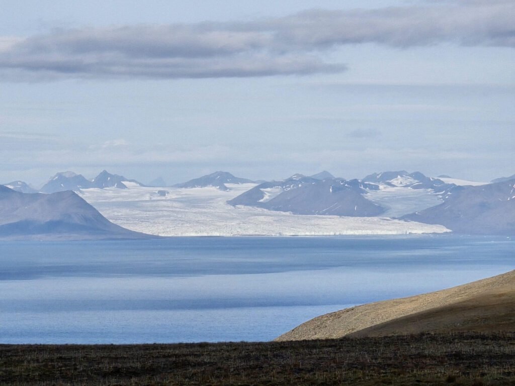
 After viewing Pyramiden from a distance, we continue on our way to the Glacier, sliding directly into the fjord. There are really no fresh icebergs today, and we see no additional wildlife. There is a cool waterfall going from under the glacier, though.
After spending 15 min or so by the glacier, we head back. Light lunch of lentil soup and bread is served on the way, and tea/coffee and snacks are available from the bar.
 We arrive back about 14:30 – stop by at the Svalbard Museum, which is a nice little museum about Svalbard’s history. It hosts special exposition now too – it is the 100-year anniversary of the signing Svalbard Treaty this year.
 Next, we have a bit of time for shopping and exploring the town. For a little town of 2500, there are plenty of souvenir shops around.
At 17:15, we’re to be picked up for our final activity, Kayaking. However, as they come to pick us up, they tell us it is too windy and Kayaking is cancelled, offering to rebook it for another day… it will not work as we’re leaving the next morning.
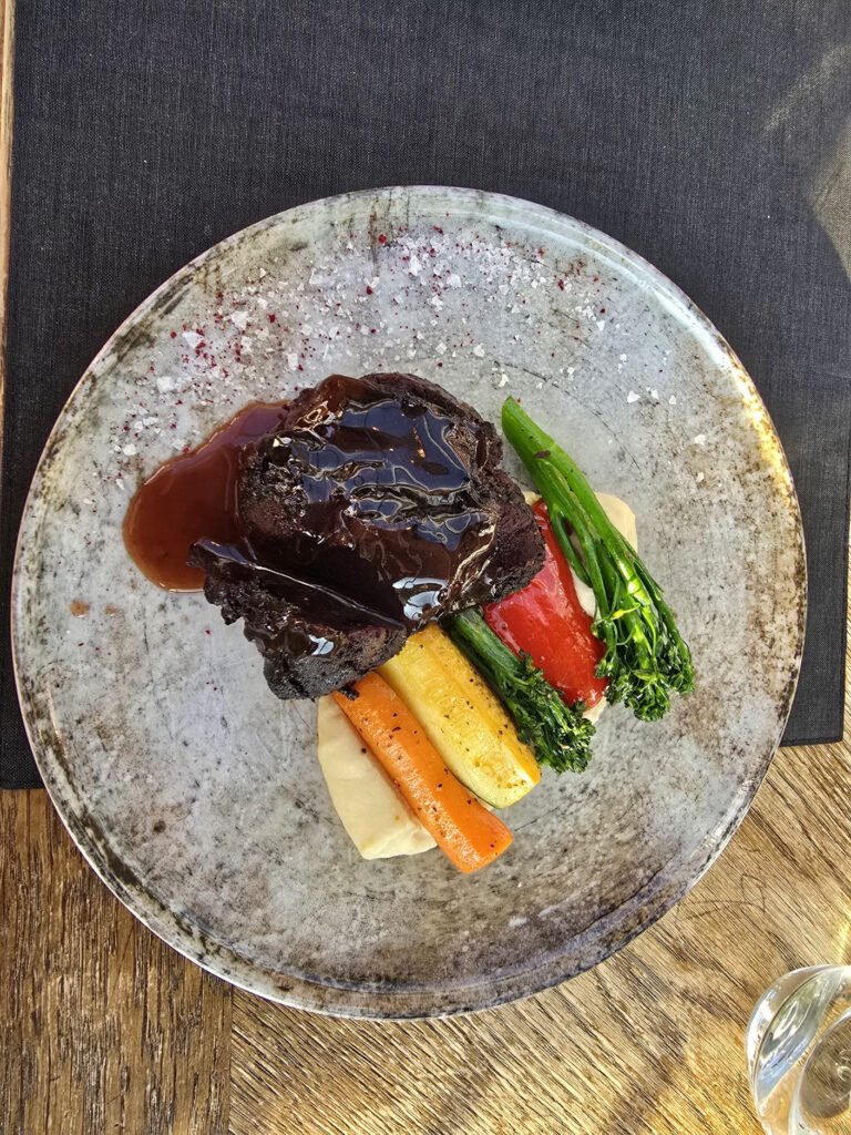 This cancellation gives us an opportunity for a nice early dinner and time to pack. We make dinner reservations at Vintergarten restaurant, which is famous for its great atmosphere and having unusual items such as Whale and Seal Steaks on the menu. Amazing deserts too.
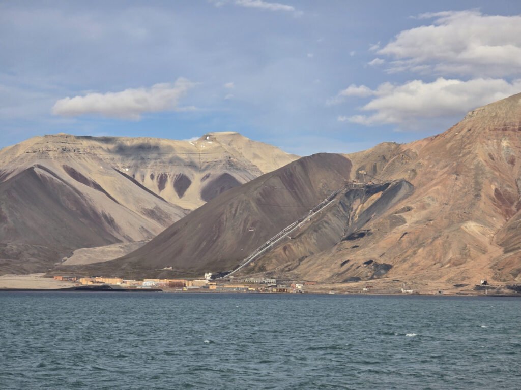
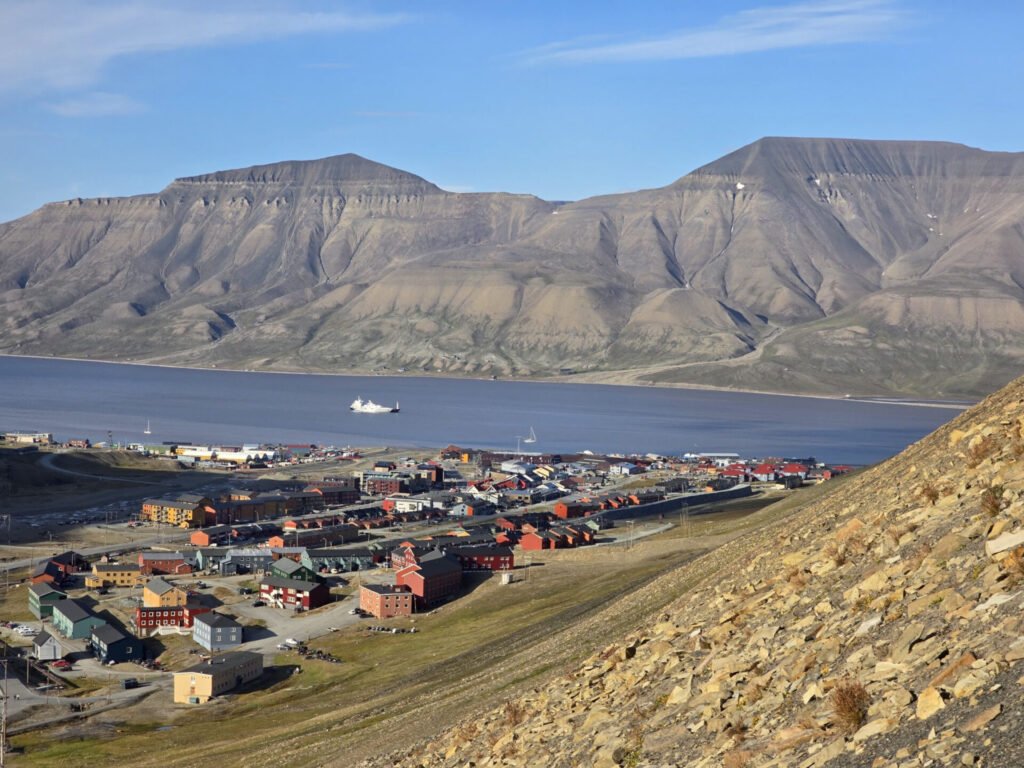
Before that last dinner in Svalbard, I took a couple of hours free to go and hike one of the abandoned mines, which you can see on the hills from the city. The hill also offers fantastic photo opportunities for the down below, especially on a sunny day as we had.
After dinner, we pack for departure
Day 6, August 12, 2025
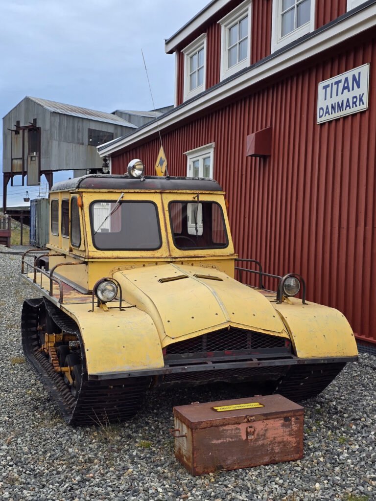 We did not quite feel like running, but also wanted to stretch before the long travel day ahead of us, so we met about 6:00 and went for a walk to explore one of remaining parts of the city we did not see before, in particular old coal processing facility – very distinctly looking building on stilts which you can see almost from anywhere in town. It is actually a museum which I would enjoy visiting… of course, it is closed at this hour
 Me, Robbie, and Jon are flying to Oslo at 10:50, and Yurii departs in the afternoon. We’re picked up from the hotel at 9:00, and it still gives us plenty of time to get to the airport, check in our bags, etc. – the place is pretty small and efficient
Good bye Svalbard, I’d love to come and see you again.
